Vestiges de l'enceinte fortifiée

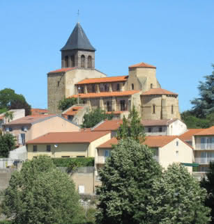
Pont-du-Château features the remains of fortified walls structured concentrically around the present-day château-town hall.
In the 12th century, Pont-du-Château was the most important stronghold in Limagne. Suger, who accompanied King Louis VI “the Fat” in Auvergne talked of “Castrum peroptimum” (leading stronghold). Pont-du-Château, which belonged to the Count of Auvergne Guillaume VI, was defeated by the King. In 1363 it was the first stronghold in Auvergne to be taken by the English.
The town developed in the Middle Ages around its fortress with its powerful square keep on the site of the present-day château-town hall. The topography shows a system of streets structured concentrically around the château sitting on a promontory overlooking the Allier. Pierre Mondanel, a historian on the city, claimed that he could see the lines of the outer walls in the layout of the streets, and compared the layout to the layers of an onion. The belfry (listed on the historic monuments registry in 1982) could be a former tower in one of the town’s exterior walls Another tower, known as “tour Cochon”, located on rue des Remparts, is identified with greater certainty as belonging to the exterior wall. The wall was protected by ditches that were developed over the centuries. An entrance gate to the city was probably located in rue de l’Hôtel-de-Ville close to rue des Remparts.
In 1954, the municipality acquired a set of 37 remarkable plans of the town. Commissioned in 1758 by Philippe-Claude de Montboissier-Beaufort-Canillac, they were executed by Gilbert Baudusson, his son Côme-Damien and Jacques-Antoine Dulaure (1755-1835), surveyors. The latter was also a geographer, historian and future deputy. He also wrote the book “Description des principaux lieux de France” (Description of the main sites in France) in 1789, of which book 5 is dedicated to Auvergne.
Prices
- Free access.


